Pan Am Games - Toronto, June 2015
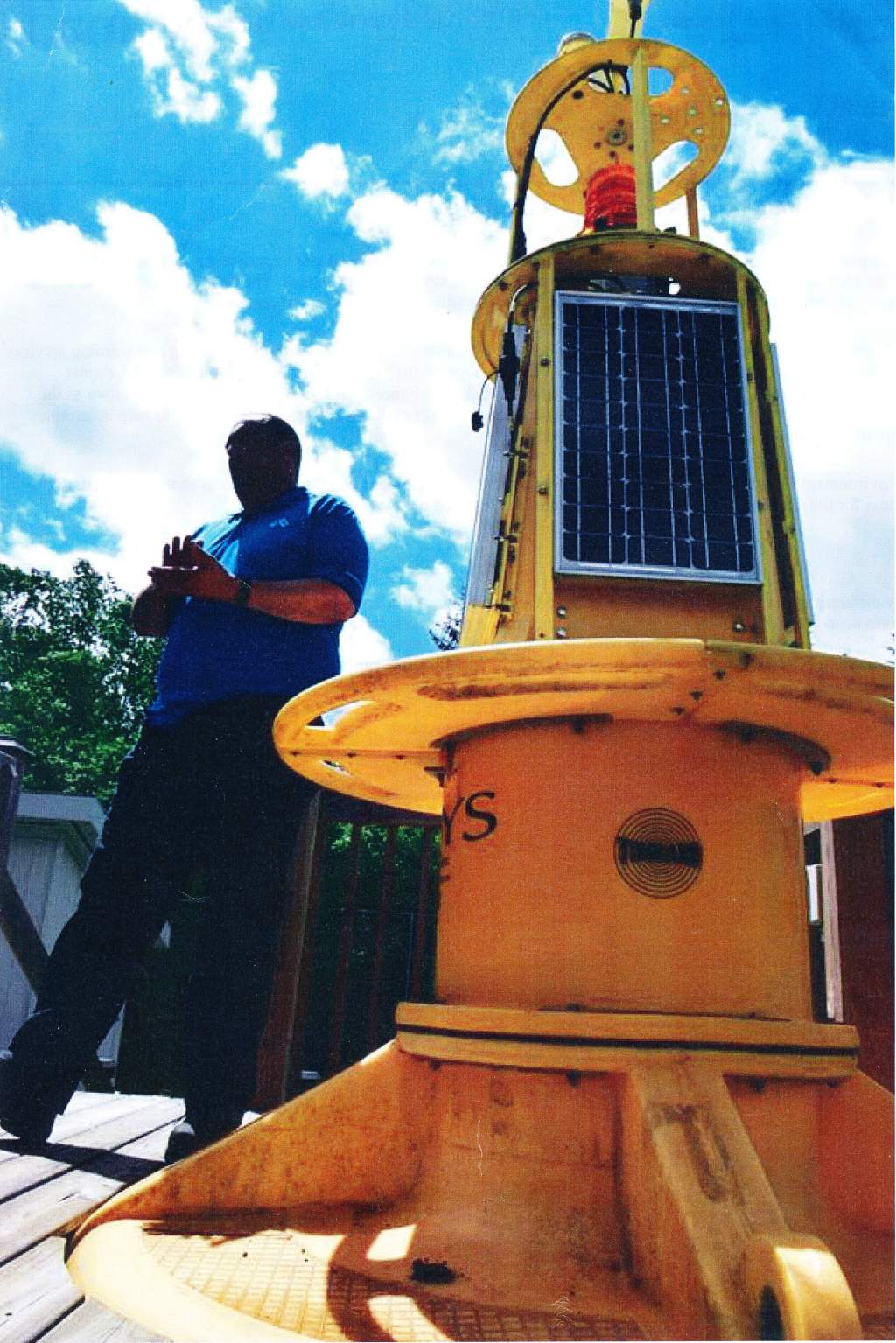 Senior Marine Technician Shawn Rickard describes the features and functionalities of a Meteorological Service of Canada lake buoy during the media day event for the Pan Am Games project. |
Description from EC Intranet Pan Am legacy thanks to science and
technology
The Pan Am Games are fast approaching, and staff is getting ready both the operational and experimental equipment and systems that will together provide the basis of a state-of-the-art weather support system for the Games. The data collected will thereafter represent a legacy of data and information post-Games that scientists will analyze for years to come. Environment Canada (EC) will be using cutting-edge science and technology to provide weather forecasting and warning services to ensure the safety of all those attending the Toronto 2015 Games. Operationally, there will be a combination of the most advanced forecasting methods with data received from a new network of enhanced weather observation stations known as the Mesonet. Experimentally, there will be a number of new types of equipment at the ready (examples below) to help determine EC's path forward for future state-of-the-art operational networks. On June 23, 2015, Environment Canada hosted a media day where an array of equipment was demonstrated to show Canadians EC's state of readiness for the Games. A few of those technologies are featured below. Buoys Two distinctly different buoys have been deployed in Lake Ontario south of the Toronto Islands. A lightweight buoy will provide new insights into near-shore directional wave conditions, permitting a surer response to wave conditions - particularly by small craft. It will be deployed into the EC operational network post-Games for ongoing support of EC's Canadian Meteorological Centre wave modeling program. The second, larger buoy is outfitted with a full suite of weather instrumentation. Its proximity to shore allows for frequent weather updates to be communicated by cell modem, a feature that EC will consider for post-Games use on lake buoys which are close enough to land for cell service. The more frequent weather updates could show an improvement in accuracy for forecasts, or response times for alerts, during active marine weather conditions. Lightning Mapping A new array of sensors has been installed around the Greater Golden Horseshoe Area, which allows for high-resolution 3D detection of " total lightning" - meaning both cloud-to-ground and in-cloud flashes. Scientists will develop methods based on this array 's information to improve the accuracy and lead time of severe thunderstorm and tornado warnings. This system will also permit EC research scientists and meteorologists to gain experience with, and understanding of, total lightning patterns. Doppler LiDAR A Doppler LiDAR (Light Detection And Ranging) system transmits laser beams which are backscattered by aerosol s such as dust and other particles in the air, permitting the real-time measurement of the wind field. This technique will be specifically used to provide the fine details of a wind field that defines a lake breeze, in particular, the vertical motions which create or enhance thunderstorms. This instrument will provide information to inform operational weather forecasts and the numerical weather prediction process which will help to improve the lead times for thunderstorm forecasts. In the future, Doppler LiDARs may also be deployed to monitor wind conditions across remote, difficult-to-monitor locations in the Arctic. Standard instrumentation cannot easily or affordably provide that functionality under Arctic conditions. Photos credit: Diane Johnston
|
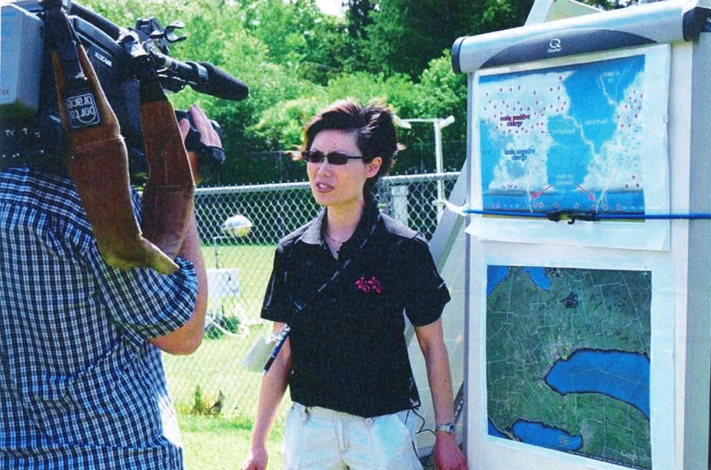 Research Meteorologist Helen Yang, being interviewed and filmed about the Lightning Mapping Array during the media day event for the Pan Am Games project. |
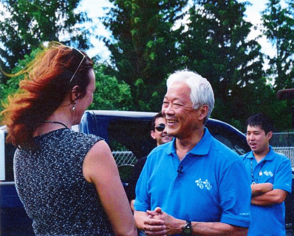 Paul Joe, Research Scientist in the Science & Technology Branch, shares information about the LiDAR during the media day event for the Pan Am Games project with CITY-TV reporter Pam Seatle. |